Met Office gives verdict for Bonfire Night as Storm Ciaran could see washout
Storm Ciaran's aftermath threatens to put a damper on Bonfire Night celebrations this weekend.
Bonfire and fireworks events on Friday night face being axed as forecasters predict a washout with a potential further storm bringing several inches of rain to parts of the country. Meteorologists fear the named storm which hit the UK this week may turn into a second - Storm Debi.
If so, Debi will be the third named storm to hit the country in one fortnight - and the second in 48 hours. While there is no confirmation as of yet, the Met Office has refused to rule out any further weather warnings for the coming days.
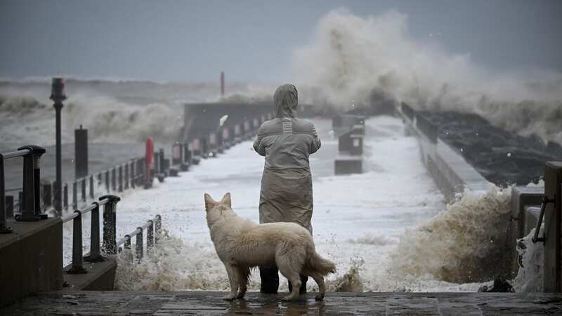
Wednesday and Thursday saw winds of up to 110mph and 30mm of rainfall batter parts of the UK resulting in homes being evacuated and transport chaos. A rare danger to life warning was issued for parts of the South coast, with more than 120 homes evacuated on the Channel Islands.
But now forecasters say the outlook for Friday could put a hold on any outdoor celebrations ahead of Bonfire Night on Sunday. The weekend is looking like a mixed bag of blustery, wet weather so far, with windy conditions expected to continue into mid-November.
 Gales, snow and rain to batter country today with 80mph wind gusts
Various events across the UK have already been called off over wet forecasts and water-logged ground conditions, including a major event at Beamish Museum in County Durham. Organisers said they'd had "no choice" and the decision had "not been taken lightly".
If you can't see the poll, click here
Met Office spokesman Graham Madge told The Express: "After Storm Ciaran, there’s a further low pressure system reaching the UK in the weekend which will bring further wet weather. At the current range, there’s not really much else I can say on it other than southern areas likely to have a wet weekend, and warning responses will be considered as the forecast develops further."
UK weather forecast
Today:
Strong winds will gradually ease through today. Areas of rain will slowly become less persistent across northern and northeastern areas. Elsewhere there will be some sunshine and a scattering of showers, heavy at times.
Tonight:
Patchy rain continuing in the far northeast with some showers in the west. Clear spells developing in places ahead of a band of rain spreading northeastwards from the southwest.
Saturday:
The north will have sunshine and showers on Saturday, whilst further wet and windy weather affects England and Wales. Rain becoming showery into the afternoon with sunny spells developing.
Read more similar news:
Comments:
comments powered by Disqus