Met Office warns snow to hit in a matter of hours as temps to plunge to 0C
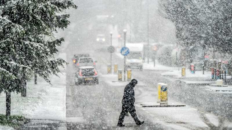
Brits have been warned of snow set to fall in some areas in a matter of hours as the mercury is set to take a plunge.
After a brief period of warmer weather, temperatures are expected to fall in the coming days. Most of the country will have drizzle to deal with, although snow is forecast in hillier areas in northern areas of Scotland. As well as the flurries, people will have colder conditions to deal with with the mercury dipping as low as 0C in some places.
The Met Office forecast for tomorrow reads: “Cloud and rain will spread across northern Scotland with some hill snow. Elsewhere, largely cloudy and mild with outbreaks of rain and drizzle. Some brighter spells in eastern England. Mild.”
For today it added: “ Starting largely dry elsewhere, and quickly clouding over. Outbreaks of rain in the southwest will gradually spread across England and Wales through the day, but it will stay mostly dry and cloudy in Northern Ireland.
“Cloudy and mild for most places tonight with outbreaks of rain and drizzle at times. Skies will stay clear in northern Scotland where it will be chilly with a frost.”
 Gales, snow and rain to batter country today with 80mph wind gusts
The temperatures are set to fall one final time this month as large swathes of the UK, as far south as Powys, Wales, will be gripped in a fresh cold snap on around Saturday February 24 and Sunday February 25 as the month ends. Forecasters with Metdesk published alarming maps, which indicate snowfall will be at its heaviest overnight into the Sunday. Many across northern England, mid Wales, and most of will wake to a blanket of snow, as much as four inches on higher ground across Scotland. Early indications suggest East Ayrshire and the surrounding parts of southwest Scotland will see the severest snowfall in the early hours.
But the low pressure drifts south during Sunday morning, and maps show parts of Derbyshire, South Yorkshire and Greater Manchester could see a small dusting. It is too early for the to issue any warnings but it does acknowledge temperatures will largely become colder by the end of the month and there will be "the potential for snow" in places.
Its long range weather forecaster says: "During late February and early March, there is a higher than normal likelihood of northerly or easterly winds dominating, which would increase the chance of colder and drier than average conditions. Spells of milder and wetter weather are still likely to occur at times, especially in the south and southwest, with the potential for snow on the boundary between milder and colder air."
Read more similar news:
Comments:
comments powered by Disqus